Top Ten Geo Stories Of 2015

flickr photo shared by Calsidyrose under a Creative Commons (CC BY 2.0) license
My mind has been brewing for some time (since early December) on how to summarize and capture the year in “geo.” I deliberately cast a wide net with “geo” mainly to capture my personal interests in geospatial technology and also geography. As I’ve been marinating and doing research on this post, I’ve had some great conversations with some folks in the great state of New York (Bill Johnson, Frank Winters, Eric Herman, Jeff Herter, and others on the NYS GAC. Additionally, a great #geowebchat on #topgeostoryof2015 with Alan McConchie helped to broaden my perspectives as well. I’m a GIS Instructional Technologist at a small Liberal Arts College in upstate NY, so my geospatial focus tend be more academic, but also focused on emerging technologies. My goal is to put together an interesting list and I’m hopeful that it helps someone who may have missed one of these stories over the past year. Additionally, another goal for would be some interaction with other like minded folks about these stories to further our collective thinking and understanding (either on Twitter or elsewhere).
Enough small talk folks, let’s jump right in.
10. First Ever GIS Analyst In A Hollywood Movie
That’s right. A character in a movie actually is a “GIS Analyst.” He also tries to explain what he does a couple times in the movie. If you are involved with GIS or mapping, you know how difficult it can be to describe what you do to others. The name of the movie is “What We Do In The Shadows.” (I watched it on HBO Go). Spoiler alert: you can also see all the parts where Stewart describes his job in the youtube clip above (just over 1 minute long). I personally think he does a good job describing GIS, and is treated a little unfairly by the crowd of vampires. Definitely check out the entire movie.

flickr photo shared by Mike Licht, NotionsCapital.com under a Creative Commons (CC BY 2.0) license
9. Register Your Drone
The big news in drones for 2015 came late. It came in the form of a “drone registration” program, which, as of this writing, 45,000 people had registered. Folks to pay stiff fines if not registered by Feb. 19, 2016. Interestingly, the AMA (Academic of Model Aeronautics) is recommending to their members, primarily hobbyists, to hold off on registering. In other drone news, 2,672 folks were approved for commercial uses of drones as of mid-December. This approval takes the form of a section 333. Overall… 2015 was a huge year for drones and the emergent regulatory environment.

flickr photo shared by dno1967b under a Creative Commons (CC BY 2.0) license
8. National Geographic Sells Out
In 2015, Fox became a 73% stakeholder in National Geographic Partners. While this was a long time coming for NatGeo due to decreased readership, the layoffs hurt, and the brands’ integrity has been brought into question. There was quite a bit of chatter online when this all happened, and I am curious what the future holds.

flickr photo shared by Javier Arce ☄ under a Creative Commons ( CC BY-NC-ND 2.0 ) license
7. Mapping Startups Rule 2015: CartoDB, Mapbox, & Mapzen
Mapping based startups made some real strides in 2015. A lot of folks were hired this year and these companies are picking up some serious talent. Other location based companies made great strides in 2015 as well: Waze and Uber all showed the world that there is still room for innovation in Location Based Technologies. Make sure to check out the offerings from CartoDB, Mapbox and Mapzen.

flickr photo shared by Ben Husmann under a Creative Commons (CC BY 2.0) license
6. Google Kills Some Mapping Solutions
Google Earth Enterprise and Google Maps Engine are shutting down. Esri, CartoDB, and others were quick to partner and announce transition programs for former Google customers. My understanding is that some of these enterprise solutions require a lot of Google employee handholding, and perhaps focusing on API’s makes more sense for Google’s hands-off business model.

flickr photo shared by U.S. Department of the Interior under a Creative Commons (CC BY-SA 2.0) license
5. Obama Signs Funding for a Well Rounded Education, Includes Geography
I’ve long known that geography was an unfunded mandate under No Child Left Behind (interpretation…it’s important, but not important enough to fund it). I dug up this post from 2003 to show it. Long story short, after 12 years, president Obama signs the “Every Student Succeeds Act” which gives some opportunities for funding geography education. The Association for American Geographers (AAG) is optimistic about the inclusion of geography and potential funding opportunities, as outlined here. You can see some of AAG’s work to support Geography Education here.

flickr photo shared by alexchaucer under a Creative Commons (CC BY-SA 2.0) license
4. Digital Map Storytelling
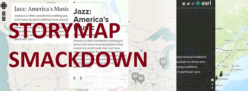
It seemed like everywhere I was seeing story maps in 2015. Esri provides some nice tools for story maps, story journals, and ArcGIS Online is making this type of data exploration and storytelling even easier. But, they are not the only platforms around. Map Story continued to make strides in 2015, and a student of mine did a comparison on some of the other platforms for digital map storytelling as well, featuring Storymap JS, Odyssey.JS, Omeka Neatline, and the Esri Story maps. I’m impressed with the new interfaces and ease for building map based story websites that I saw over the last year.

flickr photo shared by alexchaucer under a Creative Commons (CC BY-NC-ND 2.0) license
3. New Indexing System(s) for the World’s Locations
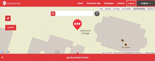
In 2015 we saw What3Words emerge as a new way of describing locations in the world. Move over Lat/Long, because 3 random words are here to reference every 3 meter by 3 meter square on earth. In 2015 we started to see w3w integration, and you can browse industry applications examples. While a three word indexing system is an innovation in itself, we also saw the truly universal language of emoji applied to a global reference system as What3Emoji also emerged in 2015.

flickr photo shared by velkr0 under a Creative Commons ( CC BY 2.0 ) license
2. The Promise of Open Source
I’m not sure exactly when it happened, but QGIS hit some sort of tipping point in the last year, and it is becoming a standalone viable a solution as GIS desktop software, and even a useful teaching tool. Here’s a great comparison of ArcGIS and QGIS that was done in November this year. Open source geospatial technology is not new, but in 2015 I saw some great strides in application. Not just in desktop, but in the deployment of maps on the web. A workable geospatial stack can produce beautiful, and functional, web-based mapping solutions. FOSS4G continues to grow and it’s not going away. Look for more growth and more beautiful maps on open platforms in 2016. Mapbox released Mapbox Studio, based on Open Source GIS and featuring some smooth vector based maps. OpenStreetMap volunteers and professionals and the Humanitarian OpenStreetMap Team (HOT) came out in a big way to help map after the Nepal Earthquake in 2015. Was 2015 THE year for Open Source Geospatial? Perhaps.

flickr photo shared by archer10 (Dennis) (63M Views) under a Creative Commons (CC BY-SA 2.0) license
1. The Auto Industry Embraces Geospatial
I’ve been hearing about Google’s Self Driving Cars for years, but it was a little bit of a surprise to see a German auto group consisting of Audi, BMW, and Daimler purchase a geospatial company in 2015. The company is called HERE, and they have roots in Navteq via acquisition by Nokia, and they were purchased for $3.1 billion. The German automakers aren’t the only ones, as Toyota plans their own realtime digital video maps. So who is Google working with? It looks like it’s Ford. And it looks like we may see an Apple self driving car announcement in 2016. Don’t forget that Tesla is creating their own maps as is Uber. As self driving cars and super accurate, realtime, photo and sensor based maps are created of the world’s roads, I wonder what the long term impact on geospatial technology will be?
Summary
Did more happen this year in the geospatial space than in other years? I think so. An auto company buys a GIS company, and drones now have to be registered like cars. Cartographic expert Natgeo stumbles as new companies focus on beautifying digital maps. Google kills mapping applications as Obama includes geography in a well rounded education. You can find me in January learning more open source GIS at stability.peanuts.think. 🙂
Special thanks to Bryan Alexander, Doug Belshaw, Joseph Kerski, and Adena Schutzberg for some thoughts about how and where to publish my first blog post of 2016, and to Alan Levine for his creative commons image tool.
![]() This work is licensed under a Creative Commons Attribution-ShareAlike 4.0 International License.
This work is licensed under a Creative Commons Attribution-ShareAlike 4.0 International License.


Nice job Alex. Your GIS year in review puts a perspective on the geospatial industry that is well thought out. Lots of hot topics and many new ways people are thinking about spatial relationships. We as an industry are moving from data analysts operating on proprietary platforms to data sharers on all platforms.
My hope for 2016? Open source is good, but widespread adoption of open standards, — Even better!
Thanks for the kind words, Verne. I believe that as Open Source grows the open standards will have to be adopted for any proprietary platform to be useful. I need to focus more on open standards in 2016, and specifically I am interested in learning more about vector tiles. https://github.com/mapbox/vector-tile-spec